
When you travel, it very often happens that a single word or image inspires you to think of the next journey. It was exactly like that with Namibia. In the Republic of South Africa, we met a fantastic guide who’d been working in Namibia for many years and who spoke about that place in such a beautiful way that we promised ourselves we would spend our next holidays there. We waited for “there” exactly one year, planning what we would see exactly. In this way, we created our 24-day route around Namibia, from the capital Windhoek, through the south and then the north of the country, to finish exactly where we started. We covered over 6000 km in dust, sometimes cold, but always delighted with the views we passed.
The beginning of our adventure
You can read about our preparations here:
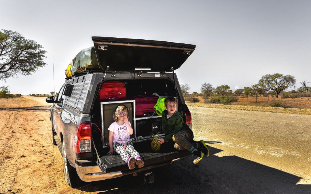
We devoted the first day to some practical matters. We collected the car from Jurek Mazgaj and his wonderful wife Helmi from Bocian Safaris – they helped us to organize the trip. The shopping took all day, a phone with a [local] card and other such matters, with which nobody wants to deal with but you have to. Afterwards, all we needed was to set off. We started our Namibian adventure at the foot of the Kalahari desert. Red sand was everywhere, and the first wild animals we saw only added to the joy of seeing Africa again. We were the most impressed with an anteater we saw during a night safari. It eats up to fifty thousand termites each night and then it goes to sleep. The Bushmen rubbed its fat on the skin to keep warm during cold mornings. It can dig so deep, we had to drive carefully, so the car wouldn’t fall into holes it leaves behind and wouldn’t get stuck with us inside. And this is how we started our Namibian adventure!
The Bushmen
We set the meeting with the Bushmen by a termite hill. There are about 25 000 Bushmen left in Namibia, and only around two thousands of them still lives in the bush, dress in animal skins and hunt for what they eat. The rest were engulfed by civilisation. Some of them work on various projects financed by organisations wanting to help indigenous people of Africa, such as traditional villages. Our village was very small – managed by one family dressed in traditional clothing, presenting everyday life of their ancestors and selling handmade objects. Of course, I’d prefer to meet them in the bush, use hand sign gestures and discover the yet unknown, but we were about one hundred years late for that 🙂
A cupid’s arrow. It looks like a bow, but is about 25 cm long. The Bushmen use it to select wives for themselves. When women dance around the fire, a young man throws such an arrow at his chosen one’s bottom, in this way showing his interest. If the woman likes the man, she puts the arrow behind a belt on her chest, which is a sign of her acceptance. And if she doesn’t like him, she breaks the arrow and throws it on the ground. Simple, isn’t it? I don’t know why we, the people who almost fly into space, have complicated those simple matters so much…
To the south of Namibia
We drive south in the direction of the Fish River Canyon. The space around us is huge and empty. No factories, no big cities, the smell of earth in the air, and for most of the day – dust. All around us mainly plants and animals we don’t know. We cover big distances, sometimes 100 km per hour, and sometimes crossing one hundred kilometres takes over 3 hours… There are surprises waiting around every corner. For example, a forest of quiver trees, called kokerboom. Up to 8 metres tall, they look like trees, but in fact they are from the succulent family. They have particularly lovely bark and look like real tough guys, but actually they are soft inside and have shallow roots. They enchant against the background of the setting sun. Right behind the forest of quiver trees, we encounter the Giants Playground, stone formations which are over 170 million years old (!), placed one on top of another – in the past they were surrounded by earth, but by now it’s rinsed so only stone is left. You can get stuck for hours in this labyrinth of rock.
The Fish River Canyon
I’ve once read a book which began with those words: “I had a farm in Africa, at the foot of the Ngong Hills (…)” and in some way they accompany me until today. “Out of Africa” and the later journeys to this land somehow made me more sensitive to smells, colours, sunsets and the otherness of life on this continent. I can certainly write about the day I woke up by the Fish River Canyon that “I had a lodging in Africa, at the foot of the Fish River Canyon” and it was an amazing experience. The second biggest canyon in the world, 550-metre deep, which you can walk through in 5 days, stole our hearts. We were travelling around its upper edges, admiring the nature’s sculptures. There was an unpleasant surprise of meeting a poisonous snake, even two, called horned adder, but actually we knew they were there and we looked around carefully. But we were totally surprised by euphorbia – a shrub growing densely in the canyon, very charming. The shrub is poisonous – three drops of milk from its branch is enough for a man to die… (at least that’s what we were said, and we’re not planning to check it).
The ghost town
Our further route led to Luderitz by the Atlantic Ocean. As we drove, the scenery was changing completely, in the end offering us a moon atmosphere and roads covered with sand lifted by wind blowing from the ocean. On the way, we stopped in a charming town AUS, behind which we saw wild horses. Supposedly, they are the only desert horses in the world. No one really knows how they got there, but there are several theories. Luderitz itself, even though it boasts a very interesting history, overwhelms with ordinariness, although that’s probably the source of its charm 🙂
Not far from Luderitz, there is a Ghost Town, i.e. Kolmanskop. The houses there, covered in sand and on the brink of collapse, experienced their period of glory a hundred years ago. When first diamonds were found in this area, hundreds of diggers arrived in the town in search of their own happiness, or rather richness. There was everything here! A casino, a railway station, electrical station, a bakery, an ice factory – even though there were only two streets in the town and only several dozen families lived there. When diamonds run out, the town emptied. But before it happened, ostriches almost became extinct. Those beautiful birds swallow stones for better digestion, and since they cannot tell regular stones from precious ones, they swallowed many diamonds which, as you can guess, made people kill them. Only when the Prohibited Area was created, entrance into which was forbidden for regular people under the penalty of prison, ostriches could breathe a sigh of relief… And even though diamonds are no longer dug in Kolmanskop, there are other areas in Namibia with diamond deposits, but you can enter them only having a special permission.
At the foot of the desert
I will remember our first day on the Namib Desert, in the area of the Namib-Naukluft National Park till the end of my life. We woke up before sunrise to climb the first sand dune we encountered. When we got close to it, the sun hadn’t appeared yet, but the brightness coming from the edge of the horizon started to illuminate the ground. We were surrounded by an endless desert prairie and absolute silence. I crouched down to take a photo with my son, and a moment later we heard a galloping oryx behind our backs. The rumbling almost echoed in our ears, in the middle of breath-taking nature. A moment later the sun rose and flooded everything with thousands shades of ochre and red. It was an absolutely magical moment.
Namib-Naukluft
In the meantime, we arrived at the heart of the Namib Desert – the Sossusvlei Valley surrounded by the highest sand dunes in Namibia. All the dunes are numbered. We climbed dune no. 45, 340 metre high, to watch from the side the highest dune in the world, no. 7, also known as Big Daddy – 43 metres higher than “ours”. Climbing sand dunes is hard work, with subsiding sand as the main obstacle. Add to that the burning sun, and we feel almost like national heroes, taking into consideration total lack of our compatriots in this country. If only we could, we would certainly hoist a Polish flag on the peak:)
Deadvlei
Another face of the Namib Desert is the Dead Valley – Deadvlei. It looks out of this world, with tree stumps directed straight into the sky, omnipresent dunes and something like dried mud (?) covering the plane of sand. The dead trees are 900 years old, and every fifty years, when it rains here, the valley is filled with water and covered with a carpet of flowers blossoming on the surface of the water. Last time it happened in 2006, so according t the statistics, for the next such miracle spectacle on the desert we’ll have to wait for about 40 years.
Sesriem Canyon
We also visited the beautiful Sesriem Canyon an then continued our journey. But before we reached civilisation, we stopped for an apple pie in Solitaire, which is mentioned in every Namibia guide. The pie is really delicious, but to truly appreciate it, I have to write that Solitaire is something even less than a settlement in the middle of the desert. It’s one farm consisting of three buildings, a petrol station, auto-tire repair and, obviously, an airport:) A long time ago, a Scottish traveller “Moose” decided to settle here and open a bakery. In the middle of the desert, in the middle of nowhere, 180 km away from the nearest town. Today, no tourist misses the apple pie in Solitaire. Unfortunately, as I read on the „board of glory” on the wall, “Moose” died in 2004, but as we can see, his crazy work and his legend survived until today.
Swakopmund
Our civilisation turned out to be a beautiful town called Swakopmund located by the Atlantic Ocean. Straight from over 30-degree heat, we entered the middle of local winter, which we finally felt. The temperature dropped to 15 degrees, and we were cold:) Swakopmund is surrounded by desert, so we made certain to check if there is any life on it. It turned out to be quite rich – snakes, geckos, lizards and even plants. A beautiful world! In the Atlantic here, due to the Benguela Current, which brings huge amounts of plankton, there are some of the biggest reserves of fish. Swakopmund itself as filled with many galleries with African art, cafés and restaurants. It reminded us of our Sopot by the Baltic:)
The Skeleton Coast
We went to the Skeleton Coast, known from the fact that many ships sank here in the shallows. All that’s left are wrecks, which are really… lovely. The salt road we drove took us to a colony of seals. The herd consisted of about 2000 animals, and each of them screamed dreadfully, and didn’t smell too well either, but we weren’t scared off by that. You can see the seals here
We bothered them for a while, and then we drove on. Several hours later, when the beautiful scenery begun to tire us a little bit, we ended up sleeping in the most beautiful place in the world. Under the Spitzkoppe mountain, by the setting sun, we grilled oryx kebabs, drank cold beer and listened to the sound of an unknown world. And when it got dark, millions of starts covered the sky, visible like in no other place in the world, and we could only guess which animal emitted the sound reminding a bit of a howl, and a bit of meowing.
The first elephants
When the first signs “careful elephants” began to appear by the road, we started to look out for them. There were more and more signs, but no elephants. Finally, we put one of the lodgy employees in the car, so he could show us where to find them. He took us 35 km away to a dry river bed, and they were there! They waited for us, at first one, and then a few more. The desert, wild elephants, just wonderful! After such a morning, we went to Twyfelfontein, inscribed on the UNESCO World Heritage List, where we admired cave paintings made 6000 years ago. When people of SAN tribe wanted to show something to each other, they drew on rocks with quartz. Giraffes, traces of some animals, other curiosities… We also finally encountered the first Herero women. At the beginning of the 19th century, they wore animal skins, but German missionaries decided it was unseemly, and ordered them to wear Victorian dresses. Puffed sleeves, corsets, sometimes bolero jackets – it’s today’s everyday life of the Herero women. They also wear a headgear shaped like cow’s horns, because for the Herero people, the cow is the most beautiful animal in the world.
The Damara people
We encountered on our way a small sign “Damara Living Museum”. We entered it. A woman dressed only in goatskin showed us one of the three programmes to pick from. We selected the programme visit to the village, traditional occupations and handicraft, as well as singing and dancing. And we got a beautiful show of how to kindle fire by rubbing wood next to dried donkey excrement (rubbing produces embers, and the embers are transported to dry grass covered in excrement), producing goat hide clothes, a presentation of plants which served or still serve as medicine for many illnesses, but the most pulling at our heartstrings were dances and songs. We lingered in the museum, but we had to get back on our way. We were accompanied by beautiful zebras.
The Himba on our way
Namibia covers an area three times bigger than Poland and has only 2.3 million inhabitants. For over half of our way we were accompanied only by the desert and very few people outside of towns. We left the desert behind, the number of people grew, we crossed the river and entered the lands inhabited by the Hereto people as well as the Himba, although the lands of the latter ones extend as far as to Kunene river, the natural border with Angola. Herero (in Victorian dresses) and Himba (dressed in animal skins and a lot of jewellery), so different from each other today, at some point belonged to the same Bantu tribe. But before we entered deeper into Himba land, we encountered a beautiful spring not far from the road. The temperature was almost 40 degrees and nothing could stop us from bathing. There were tadpoles near the shore, so the children were busy:)
We decided to visit a Himba village. But we wanted to do it our way, not buy some organized tour, where usually most of the money ends up with the organizer and just a fraction with those who let others in on how they live. From time immemorial, people have been travelling curious of other people out there, in the wide world, and we were interested in exactly the same. How others live. At a petrol station we made a deal with a Himba man who promised to take us to a real village. At first, he taught us a few words in their language: morrow (good morning), perivi (how are you), perinara (I’m fine), okuhepa (thank you). Equipped with the basic set of words, we went to the market to buy some gifts. I watched what the guide put in the basket, and it was: 50 kilos of corn flour, a few bags of sugar and rice, oil, loaves of bread and other basic supplies. And so we went for a visit. You could write a book about Himba. I’ll say just a few words. There were no men in the village apart from the chief – they were doing farm work. Each village has a chief, and he owns the biggest hut. Our chief was a rich man. He had 697 cows. Just a few of them in the village, the rest on pasture somewhere. Between the chief’s house and pen for cows there was a holy fire – okurowo. We weren’t allowed to go in between the holy fire and the chief’s house. Men have several wives, and women are simply beautiful! It might be shocking that they don’t use water for cleaning (water is worth its weight in gold here, anyway). They rub onto their bodies a mixture of butter whipped from milk, ochre and something else and they incense their body with smoke. For perfumes, they use ashes, herbs and smoke. You can say by their hairstyle if a woman is married, has children or still eligible for marriage. We spend two amazing hours with the Himba. Only the children, travelling for the first time, I think overwhelmed by their different looks, amount of jewellery and animal ornaments, as well as the smells in the air, didn’t feel comfortable. They chained themselves with invisible manacles to my leg:) By the end of the visit, the Himba sat in a circle, each of them presented their handicraft objects for sale and we couldn’t not buy something. Before we left, our guide presented the gifts we brought. And that was the end of our visit. Okuhepe!
At the border with Angola
And now I’ll write how I became a debtor of the Himba people. It was like that. After a whole day’s ride, we finally reached the border with Angola, formed by the Kunene river. Up, it is Angola, down – Namibia, and the river in the middle of the border. The river is full of crocodiles, and the banks are overgrown with monstrous palm trees and baobabs. Like a fairy tale. Despite being tired after the journey, I went with Iwo for reconnaissance. To make it before the sunset, I grabbed my child, the camera and we got into the car. The money was left behind and we set off. The first stop was Epupa Falls. A man came and told us he’d show us places with the best views. It’s absolutely normal in Africa, you need a guide here, because of crocodiles, snakes, scorpions and thousands of other things we wouldn’t dream of. It turned out our guide manages this land in the name of the Himba community. They want to build a camp, they have the land, but no money for infrastructure, so they collect it. I promised to return my debt by the next day. In the middle of the way there was a sign saying the view is paid, 40 Namibian dollars per person. I had no money so I ignored the sign, and anyway it was after sunset, so I thought it doesn’t count. The view was breath-taking. Vast waterfalls were rising up in front of us in the distance. It was beginning to get dark when I was driving down the hill and a car cut in on us, with only one light. A Himba man got out of it and told us he manages this land and I needed to pay. Once again, I promised to pay the next day, and again it wasn’t a problem. Since we didn’t have enough of the adventure, we drove with my son by the riverbank (we very much wanted to walk, but were afraid of the crocodiles), and finally we were stopped by a third man who asked if we weren’t lost. Iwo gave him a cookie, and he invited us to a local bar. The bar was pure folklore. Made from tin, with few selected alcohols and a lady who serves that alcohol from behind bars. And no tourists. We got back tired, in debt, but so happy! P.S. I paid back all my debts!
Kunene river
Kunene river is beautiful and full of crocodiles. We saw them. It’s cold for them now (air temperature is 35 degrees), so they’re a bit lazy, but still fast. The river forms a natural border between Namibia and Angola. The border was first established on the strength of an agreement between Portugal (Angola was its overseas colony) and Germany (governing in Namibia). After losing the First World War, South Africa, to which Namibia belonged, set the border again, and then once again after regaining independence in 1990. At Kunene river, we observed the life of crocodiles.
You’ll find our further adventures here, in the second part of this entry.
Spodobał Ci się wpis? Jeżeli masz ochotę wyjechać na wyprawę przez duże “W” i przeżyć przygodę życia zajrzyj na stronę https://mintadventures.com/wyprawy/ Znajdziesz tam wszystkie aktualne, organizowane przeze mnie wyprawy. Głównie na Kaukaz, do krajów południa Afryki i do Laponii. A opinie o tych wyprawach, są publikowane na stronie na Facebook @MINTAdventures“